
Table of Contents
ToggleVisual AI’s Urban Bias: MIT Book Warns of Social and Geographic Bias in City Analysis
The growing use of visual AI to study cities could transform urban planning, but it also risks reinforcing existing social and geographic biases, researchers at MIT’s Senseable City Lab have warned in a new book.
How AI Sees the City: Urban Visual Intelligence, published by Routledge, examines how artificial intelligence can analyze enormous volumes of urban imagery while also raising concerns about privacy, surveillance and the way AI systems interpret different communities.
MIT Researchers Examine How AI Sees Cities
The book is authored by Fábio Duarte, Martina Mazzarello, Fan Zhang and Carlo Ratti. Duarte is a principal research scientist and associate director of research and design at MIT’s Senseable City Lab, while Ratti is the lab’s founder and director.
The researchers examine how computer vision and other AI technologies can turn photographs, surveillance footage, satellite imagery and street-level images into large datasets for studying urban environments.
This can allow researchers to examine city life at a scale that was previously difficult to achieve.
Visual AI Can Analyze Urban Life at Massive Scale
Visual AI can be used to study a wide range of urban issues.
MIT researchers have used machine learning to identify different types of vehicles in hundreds of New York City traffic cameras and estimate emissions associated with individual vehicles. Similar approaches can help researchers study traffic patterns, pedestrian activity, public spaces, greenery and other aspects of city life.
The technology can also help urban planners examine questions such as why traffic builds up, which intersections may be dangerous and how people use parks, plazas and sidewalks.
The book argues that the major opportunity is not simply allowing computers to process millions of images, but connecting visible characteristics of cities with broader questions about how urban environments function.
How AI Can Reinforce Existing Biases
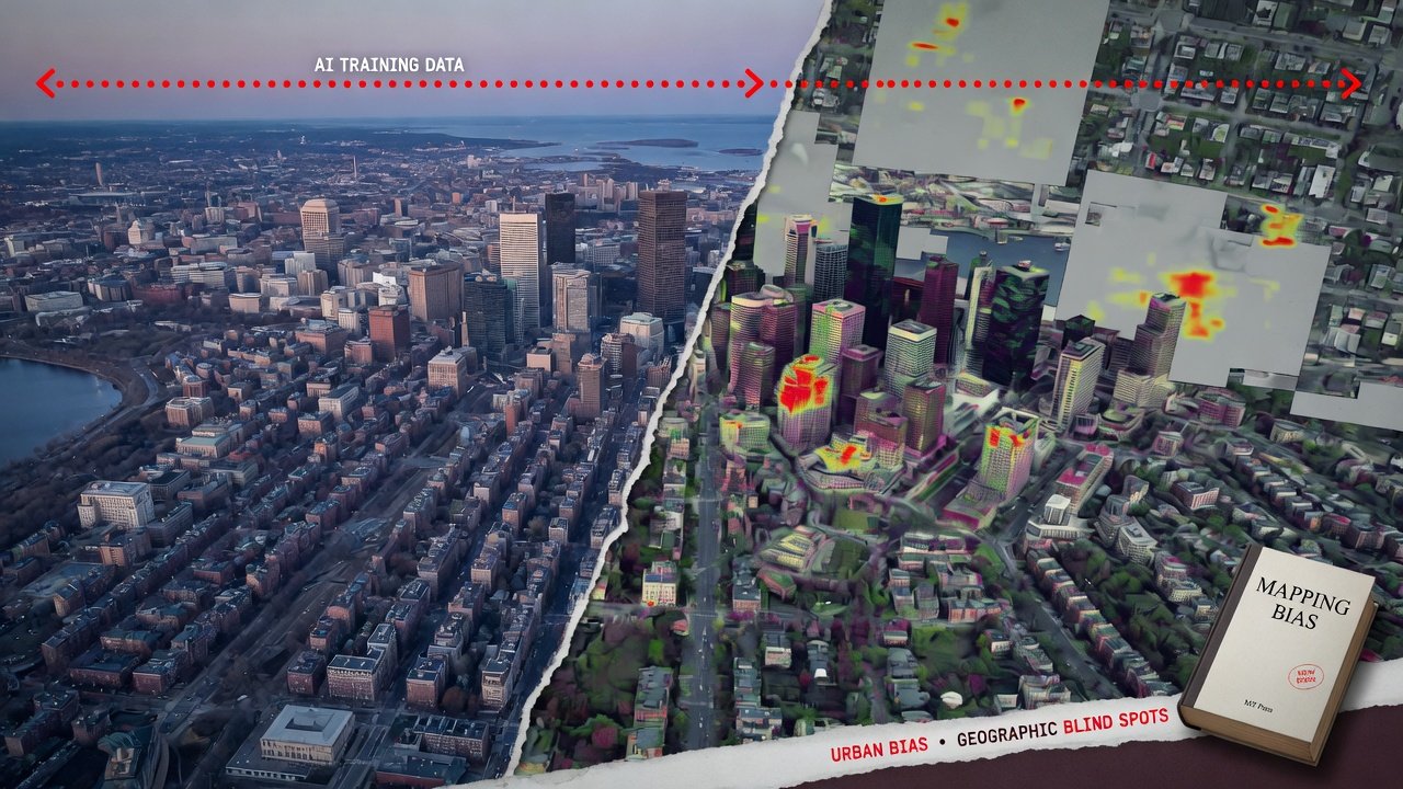
One of the central concerns raised in How AI Sees the City is that AI systems can reproduce biases contained in their training data.
If models are trained predominantly on images representing majority populations, they may perform differently when analyzing minority groups or communities that are poorly represented in the underlying datasets.
This can create a feedback loop in which AI-generated observations reinforce perceptions that already exist about particular people, neighborhoods or cities.
The researchers therefore argue that visual AI should not automatically be treated as a neutral observer. The way systems are trained and the data they are exposed to can influence what they identify and how they interpret urban environments.
Geographic Bias Can Affect Urban Analysis
The issue extends beyond demographic representation.
Cities differ significantly in architecture, infrastructure, street design, transportation systems, climate and patterns of public-space use. A model trained primarily using imagery from certain regions may not interpret other urban environments in the same way.
The book includes case studies involving cities in the United States, Stockholm, Amsterdam, Beijing, Dubai and Singapore, illustrating the geographic diversity of urban visual analysis.
This geographic variation makes the quality and diversity of training data an important consideration when visual AI is used for planning or policymaking.
Surveillance Raises Additional Concerns
The expansion of visual AI also raises questions about how much urban activity should be monitored.
The authors examine the growing use of cameras and other visual technologies in cities and warn that large-scale monitoring can create privacy concerns.
MIT News notes that London has about 210 cameras per square mile, while Shanghai has more than 5,000 cameras per square mile. The researchers argue that potential safety benefits from extensive monitoring need to be considered alongside risks to personal freedom and the possibility of misuse.
As AI makes it easier to analyze footage automatically, the implications of widespread cameras can extend beyond simply recording images.
AI Could Transform Urban Planning
Despite these concerns, the researchers also emphasize the substantial potential of visual AI.
Urban planners can use AI-assisted analysis to study transportation, emissions, public spaces, greenery and other elements of city infrastructure.
Satellite imagery can reveal the amount of green coverage in an area, while street-level and smartphone imagery can provide information about how people actually experience those environments.
The technology could therefore help planners move from limited observations toward much broader datasets when designing or evaluating urban spaces.
The Book Connects AI With Everyday City Experiences
The researchers also examine how visual AI can be used inside buildings and private spaces.
One example discussed by MIT involves a study using images from approximately 400,000 Airbnb listings around the world. The research found significant geographic differences in interior design styles rather than a complete convergence toward a single global style.
Such applications demonstrate how visual datasets can reveal patterns that may not be obvious through conventional urban research.
Why AI Training Data Matters
The concerns raised by the MIT researchers highlight the importance of understanding where AI’s visual information comes from.
A model does not observe a city in exactly the same way a human researcher does. Its analysis depends on the images available to it, the labels assigned during training, the populations represented in those images and the objectives for which the model was developed.
Poorly balanced datasets can therefore influence the conclusions produced by visual AI.
For urban planners and policymakers, this means AI-generated analysis may need to be combined with local knowledge, independent verification and other forms of evidence.
Visual AI Is Not Simply a Neutral Observer
The central message of How AI Sees the City is not that visual AI should be abandoned, but that it needs to be used carefully.
MIT researcher Fábio Duarte said AI is not neutral because how it is trained influences what it sees. Co-author Martina Mazzarello similarly noted that human observation is also shaped by perspective, meaning the challenge is to ensure that technological tools are guided appropriately.
This distinction is increasingly important as cities consider using AI for decisions that affect transportation, infrastructure, public safety and urban development.
The Future of AI-Powered Cities
The release of How AI Sees the City comes as cities generate more visual data than ever before.
AI can potentially transform that data into insights about how people move, interact and experience urban environments. At the same time, surveillance, privacy and algorithmic bias create challenges that cannot be separated from the technology’s potential benefits.
The MIT researchers ultimately advocate a careful approach in which visual AI is explored critically while its limitations and potential biases are recognized.
As AI becomes more deeply integrated into urban planning, the question may not simply be what machines can see, but whose experiences are represented in the data and how those representations shape what AI sees.
Frequently Asked Questions
1. What is visual AI?
Visual AI refers to artificial intelligence technologies that can analyze images, video and other visual information to identify patterns, objects, people, environments and other features.
2. What is How AI Sees the City?
How AI Sees the City: Urban Visual Intelligence is a 2026 book by Fábio Duarte, Martina Mazzarello, Fan Zhang and Carlo Ratti examining how AI can be used to analyze urban environments.
3. Who published the book?
The book was published by Routledge and focuses on artificial intelligence, urban analysis and visual intelligence.
4. What is urban AI bias?
Urban AI bias occurs when AI systems produce systematically different or distorted results because of limitations or imbalances in their training data, algorithms or application across different populations and geographic areas.
5. Why can visual AI reinforce social bias?
If AI models are trained primarily using images representing majority populations, they may not analyze minority groups or underrepresented communities in the same way, potentially reinforcing existing perceptions.
6. How can visual AI help cities?
Visual AI can help analyze traffic, emissions, public spaces, greenery, pedestrian activity, buildings and other elements of urban environments at large scale.
7. Does visual AI create privacy concerns?
Yes. The use of large networks of cameras and automated visual analysis can increase surveillance capabilities and raise questions about privacy, personal freedom and potential misuse.
8. What is the MIT Senseable City Lab?
The MIT Senseable City Lab is a research group at the Massachusetts Institute of Technology focused on using data and technology to understand how cities function and evolve.
9. Can geographic differences affect visual AI?
Yes. Cities have different architectural styles, infrastructure, cultures and patterns of public-space use. Models trained on limited geographic datasets may not represent other environments equally well.
10. What is the main concern about AI seeing cities?
A key concern is that AI-generated interpretations may reflect the biases and limitations contained in the data and systems used to train them. The MIT researchers argue that visual AI should therefore be applied carefully and critically.
